Coastal Wetlands and Beaches
Double-crested Cormorants, American Oystercatchers, Atlantic Brant, and more in Jamaica Bay Wildlife Refuge, Queens. Photo: Don Riepe
With its 578 miles of waterfront and vast salt marshes, New York City truly deserves the nickname “City of Water”: its waterfront is longer than those of Miami, Boston, Los Angeles, and San Francisco combined. We live in an estuary—defined as “a partly enclosed coastal body of water in which river water is mixed with seawater.” The principal river of our estuary, the great Hudson, is tidal; it was known to Native Americans as Muhheakantuck—the river that runs both ways. At high tide, the Hudson carries seawater 135 miles north, all the way to Troy, NY. Several smaller freshwater sources combine with the Hudson, among them the Passaic, Hackensack, Raritan, Rahway, and Bronx Rivers. (The City’s “East River” is not counted among them, as it is in fact an arm of the salty Atlantic Ocean.)
Estuaries like ours are considered one of the richest ecosystems on Earth—second only to tropical rainforest in terms of species diversity. When Henry Hudson arrived here in 1609, he found the harbor “rich in fishes” and saw birds “so numerous that they shut out the sunshine.” Today, New York Harbor retains much of this richness: the harbor north of The Battery is visited by 220 kinds of fish, and over 350 bird species visit us during the year.
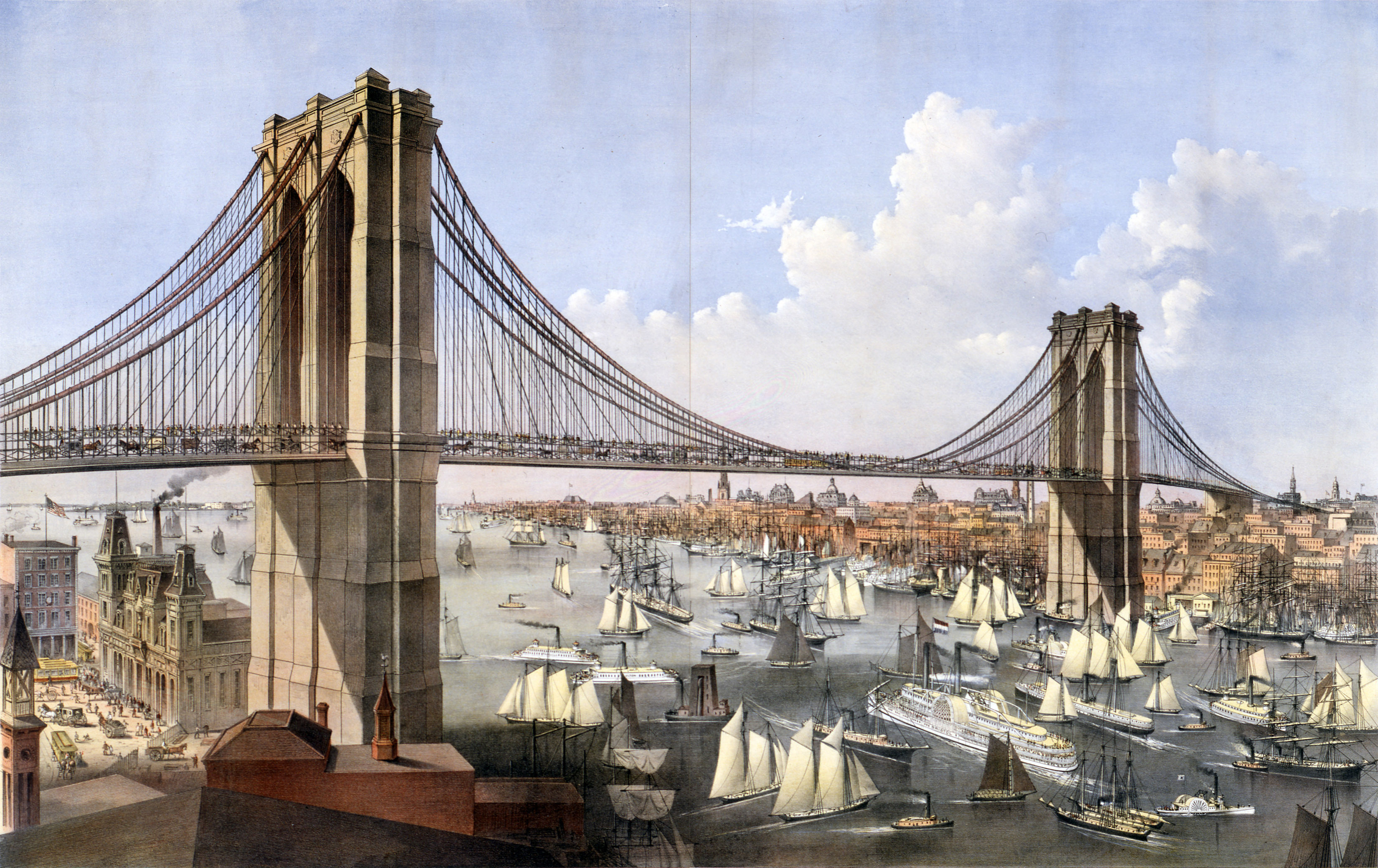
The East River in 1886, from an illustration published by Currier & Ives. Image: Shutterstock
An Ecosystem under Siege
Our rich ecosystem has not been treated well since the arrival of European settlers, however. As New York City’s population exploded from tens of thousands in the 18th century to millions in the early 20th, the environmental toll is perhaps best represented by the loss of one humble but powerful organism: the Atlantic Oyster. Vast oyster beds once lined the bottom of our estuary, filtering and cleaning our water; their countless shells gave the name to Pearl Street in lower Manhattan. As late as 1851, a visitor to the City remarked that "everyone here seems to eat oysters all day long.”1 New York City was known for its excellent oysters, and exported them all over the world.
The City’s human population boom, accompanied by the lack of an organized sewage system, however, took a terrible toll—and before long the harbor’s oyster beds were smothered by a layer of sludge up to 10 feet deep. By 1906, newspapers published reports of “seas of floating garbage.” By 1914, the City had closed its public beaches. Intensive industrial development also resulted in our city hosting some of the most polluted sites on the planet, among them Gowanus Canal and Newtown Creek. The City’s last commercial oyster bed was closed in 1927. Oysters were functionally extirpated from the harbor, and much of the harbor’s marine life along with them.
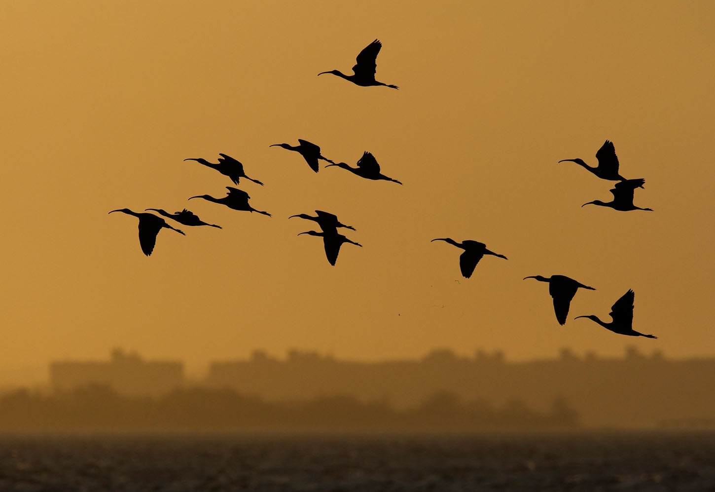
Glossy Ibis were among the first wading birds to breed in New York City in the 1970s, after many decades of absence. Photo: François Portmann
Environmental Recovery
Thankfully, the environmental conservation movement launched by the Audubon Society and others in the late 19th century eventually came to bear on this mistreatment of our harbor. In 1970 Governor Nelson Rockefeller created the Department of Environmental Conservation. (The federal Environmental Protection Agency formed the same year.) The 1972 Clean Water Act, passed by a bipartisan congress over a Nixon veto, was a huge victory for the environment.
As if they’d heard the good news, in 1974 our Harbor Herons returned to breed off Staten Island—and have since spread across the harbor. In 1992, all NYC beaches opened for swimming for the first time in almost 80 years. In 2010, whales were sighted in New York Harbor for the first time in 100 years, and have become increasingly common. And over the last decade fish-eating Bald Eagles, having also benefited from the protective environmental laws of the 1970s, have become year-round residents in New York City. Eagles nest in several nearby locations on Long Island and New Jersey, and it seems likely they will soon raise young in New York City.
While much work remains to be done, the resilience of nature that we all witness today is astounding.
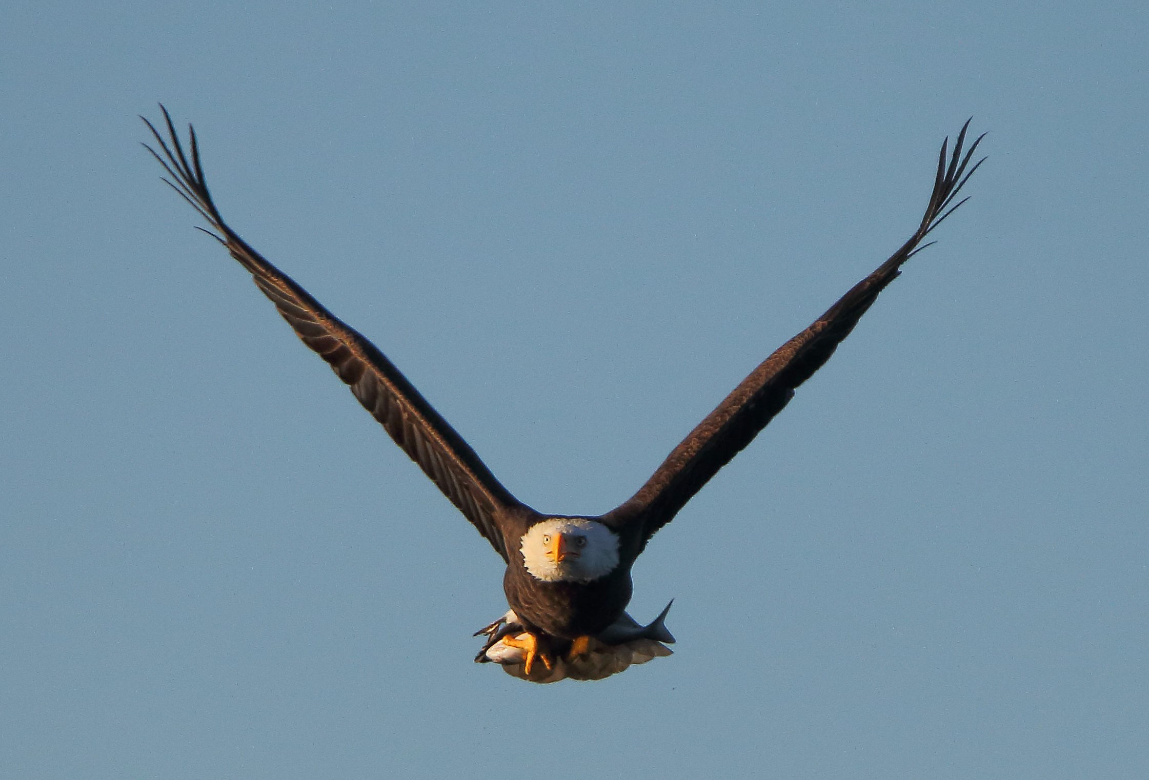
A local Staten Island Bald Eagle with its catch, in 2015. Photo: Lawrence Pugliares
Water Quality and Stormwater: A Continuing Challenge
Though our estuary’s water quality has certainly improved since the environmental disaster of the late 19th and early 20th centuries, the harbor still suffers from the legacy of that population boom, and the lack of sustainable planning for both sanitary sewage and stormwater (runoff from rain and snow). Progress has been made in modernizing our water treatment systems, but to understand the challenges our wetlands systems face, we must understand how the City deals with its waste and stormwater. Modern-day New York City has two kinds of systems to handle sanitary sewage and stormwater, depending on one’s neighborhood: Combined Sewer Overflow (CSO) and Municipal Separate Storm Sewer System (MSSSS, or “MS4”). Both systems may contribute to the degradation of our wetlands, in different ways. Learn more about the issues of stormwater and water quality.
Priority Wetland Habitats
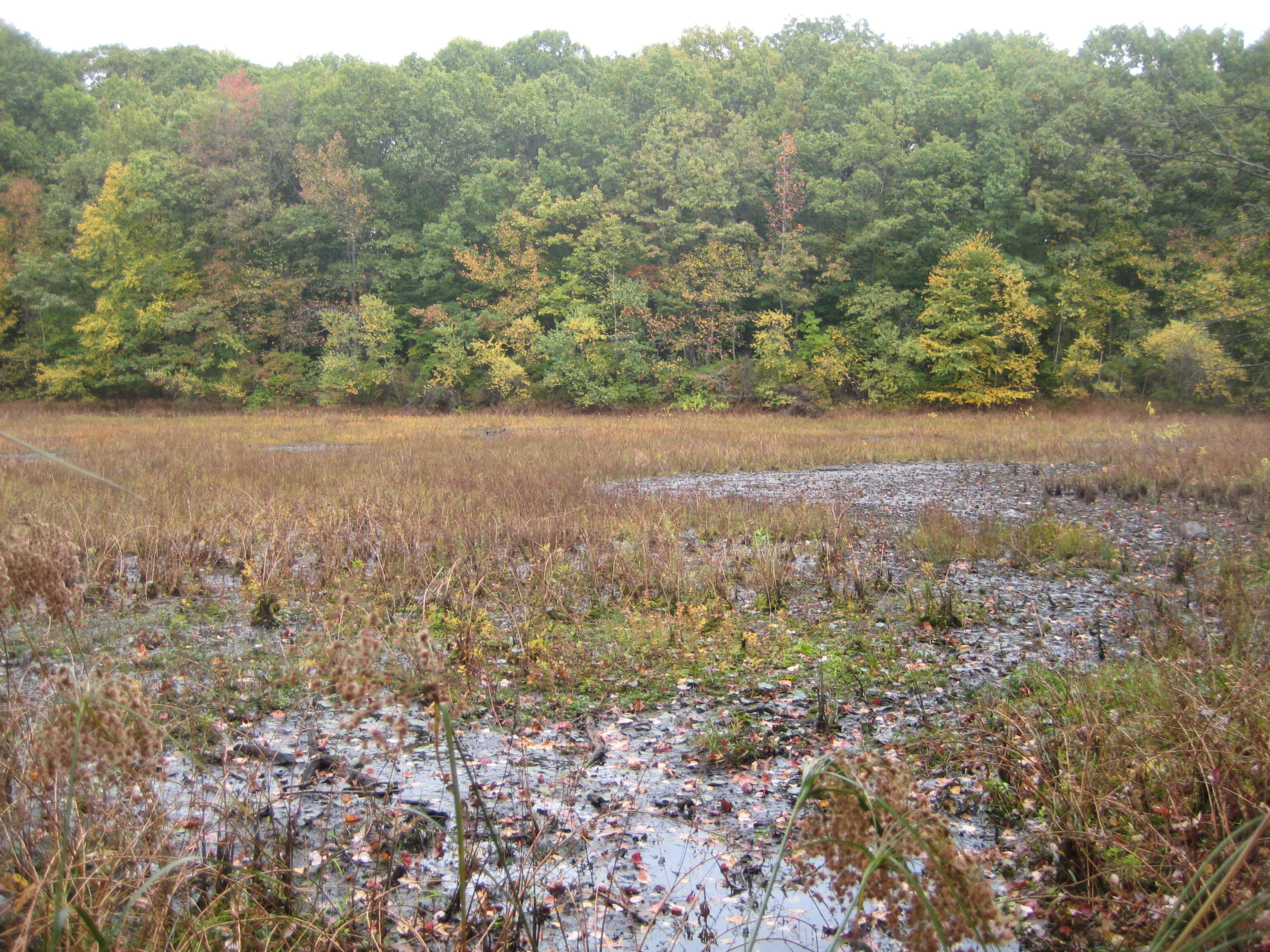
Thanks to work by dedicated NYC Bird Alliance pioneers, much New York City wetland habitat has been preserved from development over the last 40 years. NYC Bird Alliance continues to identify priority habitats and advocate for their preservation and protection.
Staten Island
NYC Bird Alliance has worked in coordination with borough, citywide, and national conservation groups to protect open space along the Staten Island shore. One of our early successes was winning protection for the islands in the Arthur Kill and Kill Van Kull first re-colonized by wading birds in the 1970s. In 2001, we co-produced with the Trust for Public Land, An Islanded Nature: Natural Area Conservation and Restoration in Western Staten Island, including the Harbor Herons Region.
Northwest Staten Island
Along Staten Island’s north and west shore, where the Arthur Kill divides Staten Island from New Jersey, a network of marshes and creeks persists among housing, roads, bridges, shipping terminals, and other commercial facilities. We have been vigilant in advocating for the protection of this marshland habitat, which is at risk from further construction and other proposed projects. We advocated for the preservation of Goethal’s Bridge Pond. We also participated in the City’s Wetlands Transfer Task Force, established in 2005, which was successful in its efforts to preserve Arlington Cove Marsh instead of keeping it in reserve for possible expansion of the nearby container port. In 2007, the Bloomberg administration approved preservation of this wetland complex as a NYC park. Read the Mariners Marsh Park and Arlington Marsh Master Plan.
The task force also determined that an additional 76 small parcels on Staten Island should go to the Department of Environmental Protection for its Bluebelt natural stormwater control program. More than 100 properties throughout the five boroughs were identified as potentially appropriate parkland, but needing further review.
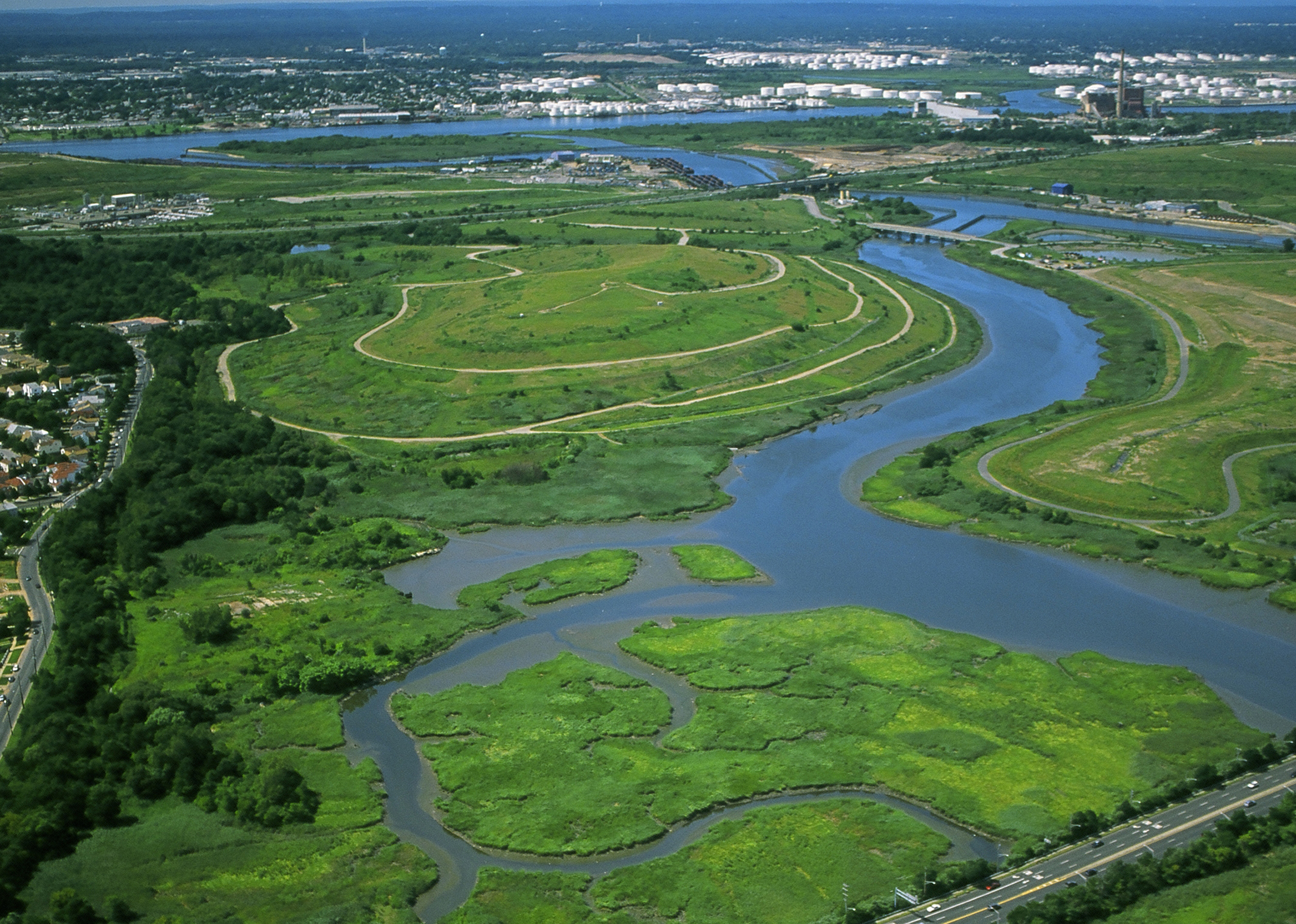
Staten Island’s Freshkills Park encompasses a vast area of tidal creeks and marshes. Photo: City of New York, NYC Parks, Freshkills Park
The Fresh Kills Watershed
A green bridge between Staten Island’s northwestern marsh areas and the Staten Island Greenbelt has been created by preservation of the 2,200-acre Freshkills Park, on the site of the Fresh Kills Landfill. The name “Fresh Kills,” from the Dutch “kille” meaning “riverbed” or “water channel,” refers to the tidal wetland system formed by a network of freshwater and estuarial creeks that drain much of western Staten Island, emptying into the Arthur Kill.
While deserved attention is paid to the ongoing reclamation of the Fresh Kills landfill mounds as grassland habitat, Freshkills Park also includes and protects large wetland areas, including the Fresh Kills waterways themselves. This brackish habitat hosts nesting Osprey, Marsh Wren, and Forster’s Tern. These now-preserved areas are contiguous with preserved wetlands such as Isle of Meadows marsh and William T. Davis Wildlife Refuge, and together, the preserves include the three major Fresh Kills tributaries of Main Creek, Richmond Creek, and Springville Creek.
Clay Pit Ponds State Park Preserve
This 265-acre natural area in southeastern Staten Island is recognized as one of the City’s nine “Important Bird Areas” (IBAs) in National Audubon Society’s global effort to identify and conserve areas that are vital to birds and other biodiversity, and is the only state park on Staten Island. The preserve includes a variety of habitats including ponds, streams, sand barrens, and woodland. NYC Bird Alliance and Audubon New York collaborated in the erection of a Chimney Swift tower in the park, in view of the visitor center observation window.
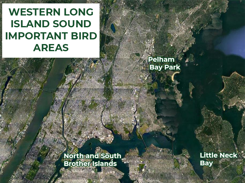
Three sections of western Long Island Sound have been recognized as “Important Bird Areas”: North Brother and South Brother islands, two of the islands used for breeding by long-legged wading birds in the City’s waters; Pelham Bay Park, which provides habitat for the city’s remaining breeding forest and wetland species as well as for migrants; and Little Neck Bay to Hempstead Harbor in Nassau County, an important waterfowl wintering area. Photo courtesy of Google Maps
Western Long Island Sound
Western Long Island Sound, the area where the sound narrows and connects to Upper New York Bay through the tidal strait known as the East River, suffered tremendous degradation during the growth and industrialization of New York City. More than a century of dredging and filling wetlands, rerouting watercourses, removing rocky outcroppings, and hardening the shoreline has profoundly disturbed the landscape around the sound and altered the tidal system. Continued development and expected sea level rise further threaten the natural land that remains.
The western part of the Sound is also seriously impacted by high nitrogen levels in treated sewage discharged from the city’s treatment plants, as well as from combined sewage overflows, contributing to dead zones where there is too little dissolved oxygen to support aquatic life. The water and sediment are also contaminated with toxic chemicals from industry along the Bronx River, which drains into Western Long Island Sound, and from landfills that continue to leak hazardous substances.
Nevertheless, three sections of western Long Island Sound have been recognized as Important Bird Areas:
- North Brother Island and South Brother Island, two of the islands used for breeding by long-legged wading birds in the City’s waters
- Pelham Bay Park, which provides habitat for the city’s remaining breeding forest and wetland species as well as for migrants
- Little Neck Bay to Hempstead Harbor in Nassau County, an important waterfowl wintering area
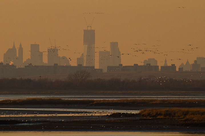
Much of NYC Bird Alliance’s early habitat preservation work involved the protection of undeveloped properties bordering Jamaica Bay. Photo: François Portmann
Jamaica Bay
Jamaica Bay is New York City's largest wetland, and part of the country’s largest urban wildlife refuge, Gateway National Recreation Area. Sheltered from the Atlantic Ocean by the Rockaway Peninsula, this estuarine mosaic of open water, islands, tidal wetlands, beaches, ponds, upland fields, and woods provides habitat for more than 325 species of birds, including breeding colonies of long-legged waders, nesting grassland birds, and the largest concentration of beach-nesting birds in the Northeast. Wintering Atlantic Brant, Snow Geese, Bufflehead, and other waterfowl congregate in the bay by the thousands. And during migration, the bay is a crucial stopover and staging area for migratory shorebirds. Other wildlife of the Bay includes 35 species of butterflies, 100 species of fish, and many rare and endangered plants.
NYC Parks Commissioner Henry Stern signing over management of Dubos Point Sanctuary to NYC Bird Alliance. Also seated (left to right): past Board Member Drew Lehman and past Board President and Secretary Geoffrey Cobb Ryan. Standing (left to right): Bernard Blum of Friends of Rockaway, Marc Matsil of NYC Parks, past Board President and Vice President Albert F. Appleton, and NYC Parks Deputy Commissioner Diana Chapin. Photo: Calvin Wilson/NYC Parks
A History of Habitat Preservation
The preservation and restoration of Jamaica Bay has been a principal focus of NYC Bird Alliance’s habitat work over the past 40 years. Buffer the Bay and Buffer the Bay Revisited, seminal reports produced in 1987 and 1993 by NYC Bird Alliance and The Trust for Public Land, identified open space near the bay In Queens and Brooklyn for public acquisition and restoration. The reports’ recommendations have been guiding conservation throughout the bay for more than 20 years and remain the framework for ongoing efforts.
With additional collaboration from the American Littoral Society, NYC Bird Alliance worked to have the most ecologically valuable properties, most of which belonged to New York City agencies, transferred to New York State or NYC Parks. The Jamaica Bay habitats permanently protected under the Buffer the Bay program included Dubos Point Wildlife Sanctuary (see photo above), Brant Point Wildlife Sanctuary, Vernam Barbadoes Terrapeninsula Preserve, and Bayswater Point State Park, in Queens, and Four Sparrow Marsh Preserve and Fresh Creek Nature Preserve, in Brooklyn.
An Altered Ecosystem
This successful preservation of land in Jamaica Bay has been accomplished in the face of great challenges. The biological richness of the bay persists despite it being surrounded by a nearly completely paved-over, built-up, and industrialized watershed. The effects of intensive human activity since the nineteenth century have taken a heavy toll on this complex ecosystem and threaten its future productivity. Extensive physical alteration of the shoreline and bay bottom, together with widespread pollution, have affected the hydrology and water quality of the bay. And since the mid-1970s, an accelerating loss of intertidal salt marsh wetlands has occurred.
An excess of nitrogen in wastewater entering the bay is thought to be at last partly to blame for the loss of Jamaica Bay’s salt marsh. NYC Bird Alliance has advocated in support of campaigns by local organizations such as the American Littoral Society and Jamaica Bay Ecowatchers, which have worked determinedly to bring attention to this problem, and to the restoration of Jamaica Bay in general. As a result of these efforts, in 2011 the City committed to making changes to the wastewater management system around the Bay. While these changes have been under way, advocates for the Jamaica Bay must remain vigilant in the fight for the Bay’s water quality. Learn more about this problem and the City’s plan to improve water quality in Jamaica Bay.
Proposed Expansion of JFK Airport
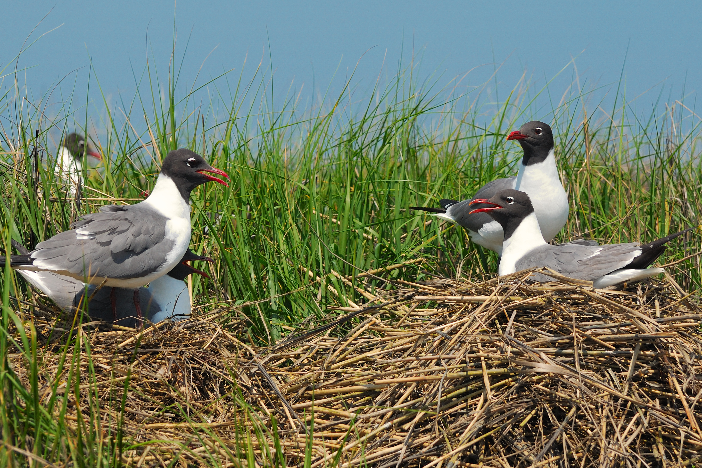
In 2011, NYC Bird Alliance joined with the Natural Resources Defense Council (NRDC) and 18 other conservation and civic groups to send a letter to New York officials opposing a proposal to expand John F. Kennedy International Airport into Jamaica Bay. Such development would have unacceptable impacts on what’s widely considered New York City’s ecological crown jewel, and in particular on a large colony of Laughing Gulls, Common Terns, and Forster’s Terns that is adjacent to the airport runways. NYC Bird Alliance will continue to oppose plans to further encroach upon the Jamaica Bay Ecosystem.
Citations
- Waldman, J., 2012. Heartbeats in the muck: the history, sea life, and environment of New York Harbor. Fordham Univ Press.
